Tendring Colchester Borders Garden Community Development Plan Document (DPD)
Chapter 4: Nature
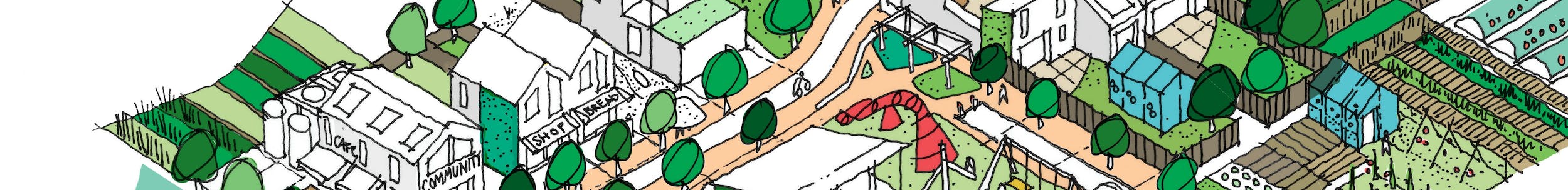
The outdoor natural environment of the garden community will be its biggest asset. It will comprise green infrastructure where neighbours will spend time, play, interact and grow. It will provide a natural support system for both people and wildlife.
This chapter sets out the policy expectations in relation to nature and green- blue infrastructure. The natural environment of the Garden Community will be its greatest asset. Nature will be placed at the heart of the development to contribute towards nature's recovery, to realise the wellbeing and economic benefits to individuals, and to deliver nature-based solutions. A well-connected, multifunctional green-blue infrastructure network will help to create a community where neighbours can interact, live active lifestyles and where nature can thrive.
Section 1 Local Plan
Under the theme of Nature, the main requirements covered in this Plan, as set out in the policies of the adopted Section 1 Local Plan, include:
- Create distinctive environments which are based on comprehensive assessments of the surrounding environment and that celebrate natural and historic environments and systems, utilise a multi-functional green-grid to create significant networks of new green infrastructure including a new country park at the garden community, provide a high degree of connectivity to existing corridors and networks, and enhance biodiversity.
- Natural measures to avoid, protect and/or enhance wildlife areas within and surrounding the site such as Bullock Wood Site of Special Scientific Interest (SSSI), Ardleigh Gravel Pits SSSI, Wivenhoe Pits SSSI, Upper Colne Marshes SSSI and habitats sites of international importance.
- Measures to incorporate biodiversity creation and enhancement measures.
- A network of multi-functional green (and blue) infrastructure incorporating key elements of the existing green assets within the site and also including new community parks, allotments, a new country park and the provision of sports areas and play areas with associated facilities.
- Provision of water and wastewater mitigation measures including the use of open space to provide flora and fauna rich sustainable drainage solutions.
Principles
A PLACE SHAPED BY NATURE AND LANDSCAPE
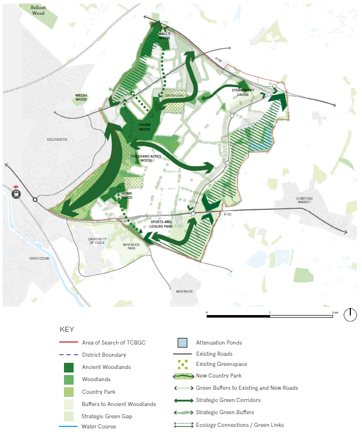
The Garden Community will incorporate important existing landscape features and provide a high degree of connectivity to existing green corridors and networks. Alongside a new Country Park provided along the Salary Brook Corridor it will also deliver a variety of new spaces - parks, fields, wild spaces, communal spaces, private places, secret spaces.
A PLACE WITH THRIVING ECOLOGY AND BIODIVERSITY
Net Gains in biodiversity and a thriving ecological network will shape the Garden Community ensuring native species thrive. Key assets within the Garden Community site including Salary Brook Local Nature Reserve, Welsh Wood Local Nature Reserve, ancient woodland, species rich hedgerows, areas of species rich grassland and valuable wetlands will be protected and/or enhanced and linked into the wider natural ecosystem network through habitat creation and management.
A PLACE WITH A PRODUCTIVE AND CLIMATE RESILIENT NATURAL LANDSCAPE
The landscape of the Garden Community will be informed by inclusive community design and provide a range of productive uses such as orchards, allotments, and growing fields. Natural flood risk management and carbon capture will be seamlessly incorporated in the ecological network, making the natural landscape "work hard" and deliver multiple benefits simultaneously.
NATURE ILLUSTRATIVE FRAMEWORK PLAN
*The location of specific land uses, facilities and activities are illustrative and subject to further masterplanning.
(28) GC POLICY 2: NATURE
The approach for the Garden Community is to protect and enhance the existing green-blue infrastructure network for the benefit of people and wildlife. There are numerous natural and historic assets, such as ancient woodlands and hedgerows, and the Wivenhoe Park Registered Park and Garden, within or adjoining the Garden Community. Development will protect and enhance existing assets and incorporate these into a well-connected green-blue infrastructure network.
Biodiversity, geology, heritage assets, archaeology and landscape character will be protected and enhanced. A multifunctional green- blue infrastructure network will be provided within and link beyond the Garden Community, providing space for nature, recreation and encouraging active travel; creating settings for the built environment; and enhancing local landscape character. This includes a country park along the western boundary of the Garden Community and a strategic east-west green corridor. Green-blue infrastructure will be an integral part of and means to improve the quality of the built environment and should optimise the provision for additional wildlife habitat.
Part A: Green-Blue Infrastructure
The Strategic Masterplan includes a Nature Layer for the whole site clearly demonstrating green links, including green corridors, within and beyond the site. The Nature Layer is coordinated with active travel networks to maximise the potential for routes through green infrastructure to be used for travel and leisure.
Connections must be made to the existing Colchester Orbital (a circular walking and cycling route around the City's perimeter) which runs along Salary Brook and through the site, linking key open spaces and public rights of way (PRoW). The Colchester Orbital will be retained and enhanced as a significant green link within the development, connecting to substantial green corridors within the development formed around the existing green infrastructure network.
Existing landscape features, PRoW and the network of lanes within the site should be retained, enhanced and incorporated into the development to form part of the green-blue infrastructure network and public realm wherever possible. A variety of new open spaces and other green-blue infrastructure will be created, including a Country Park along the Salary Brook corridor, including the slopes, and multiple green corridors. Proposals will need to include details of a green-blue infrastructure network, how it complies with the strategic masterplan and must demonstrate how all open spaces connect to this network.
Green-blue infrastructure must deliver multiple benefits and proposals must demonstrate or provide:
- How the amount, typology and function of new open space and other green-blue infrastructure meets the standards in the Colchester and Tendring Sports, Recreation and Open Space Strategy (2022) or any updates to this strategy.
- How biodiversity enhancement and net gain measures will be incorporated, including the use of habitat restoration and natural regeneration.
- How the design supports the dispersal and migration of individual species and whole habitats, either as part of a regular movement pattern or through migrations in response to climate change.
- How the green-blue infrastructure proposed will be managed and maintained as part of the stewardship model.
- That the strategy for selection of trees and other plants has been chosen to enhance both nature and beauty, for climate resilience and for food. For example, through drought tolerant or wetland planting approaches as appropriate.
- Details of street trees and hedgerows and that appropriate measures are in place to secure long-term maintenance of newly planted trees.
- Details of how existing trees and hedgerows will be incorporated into the development.
- How natural or free play areas have been incorporated into the urban setting as well as green spaces.
- The provision of areas of wild bird cover for the benefit of farmland birds.
- The creation of verges of priority habitat, hedgerow, wildflower- rich or rough grassland along roads, streets where appropriate, and pedestrian and cycle networks.
- High quality, sustainable design and selection of public furniture, including play equipment, and lighting (where appropriate), which is essential to ensure that places are accessible and inclusive.
- Inclusive and accessible to all, including people with varied mobility and sensory needs.
Proposals will be required to provide an appropriate amount of Suitable Accessible Natural Greenspace (SANG), in accordance with Natural England (NE) guidance. This will reduce the amount of day- to-day recreational trips to the sensitive Essex coast. Proposals to incorporate the SANG within the new Country Park will be supported where they conform to the principles of the Strategic Masterplan and where evidence, including visitor surveys, is provided to demonstrate that the Salary Brook Local Nature Reserve has sufficient capacity to accommodate any increased visitor usage proposed in order to count towards SANG provision.
Part B: Integrating Green and Blue (water) Spaces into Built Form
A key principle and part of the distinctive character of the Garden Community will be the green-blue infrastructure network and celebration of the natural and historic environment. Proposals should take every opportunity to integrate green and blue spaces and will be required to demonstrate, both spatially and technically, how they have been integrated into the built form. Examples include: tree lined streets or streets that contain hedgerows appropriate to local character, habitats, and species; insect-attracting plants, hedgerows, log piles, and other places of shelter for wildlife refuge/hibernation within structural landscaping and open spaces; hedgehog friendly features in residential garden boundaries to create linked habitat; dark corridors for bat foraging; green walls and roofs and other measures of incorporating trees and plants into buildings; bat boxes, bricks or lofts and bird boxes; green roofs; and Sustainable Drainage Systems (SuDS).
Part C: Protection of Biodiversity
Proposals will need to provide the following:
- Are supported with appropriate ecological surveys where necessary.
- Where there is reason to suspect the presence of a protected species (and impact to), or Species/Habitats of Principal Importance, proposals should be accompanied by an ecological survey assessing their presence and, if present, the proposal must be sensitive to, and make provision for their needs and demonstrate the mitigation hierarchy has been followed.
- Will minimise fragmentation of habitats.
- Maximises opportunities for the preservation, restoration, enhancement, and connection of natural habitats in accordance with the Local Nature Recovery Strategy or future replacements.
Sensitive habitats should be buffered with additional planting or other agreed appropriate measures wherever possible to discourage access. Appropriate interpretation/signage will be required to help divert visitors away from sites that are sensitive to recreational disturbance, including the use of marketing and promotional material at the point of house sales. Ecologically rich buffer landscapes against existing and new road corridors will be required. The minimum widths of these will be agreed through an appropriate design code or similar.
Part D: Biodiversity Net Gain
- Proposals must deliver a minimum of 10% measurable biodiversity net gain across the whole site with gains delivered either on-site or immediately adjacent to the site in accordance with the mitigation hierarchy, and must follow the latest Defra Metric, and its accompanying guidance, as well as local guidance where applicable. Initial high-level testing of BNG calculations of the strategic masterplan indicate that in excess of 10% can be achieved on average across the masterplan allocation. As such the ambition is to achieve a BNG of 15% on average across the whole masterplan.
- Biodiversity net gain must be delivered in addition to following the mitigation hierarchy, sound ecological principles, and overall high quality urban and landscape design.
- As a priority, impacts on moderate and high distinctiveness habitats must be avoided wherever feasible.
- Biodiversity net gain should include measures at the strategic and neighbourhood level. Other street and household level enhancements should form part of the general biodiversity and landscape enhancement measures.
- Biodiversity net gain calculations should be completed for the area covered by the Strategic Masterplan and updated in respect of each individual development proposal. Habitat enhancement and creation relating to each proposal should ideally be contained within their respective boundary where this will deliver the best outcomes for biodiversity. There is a preference for biodiversity offsetting to be defined by cross-referenced plans and located within the Garden Community. The Councils will provide coordination to ensure no double-counting between proposals. The Council will work with developers to maintain iterative biodiversity net gain accounting for the entire Garden Community as proposals come forward. Habitat enhancement and creation for delivering biodiversity net gain within the Strategic Green Gaps, Salary Brook Country Park, SANG and SuDS will be supported, where true additionality through stacking of ecosystem services can be demonstrated.
Part F: Productive Landscapes
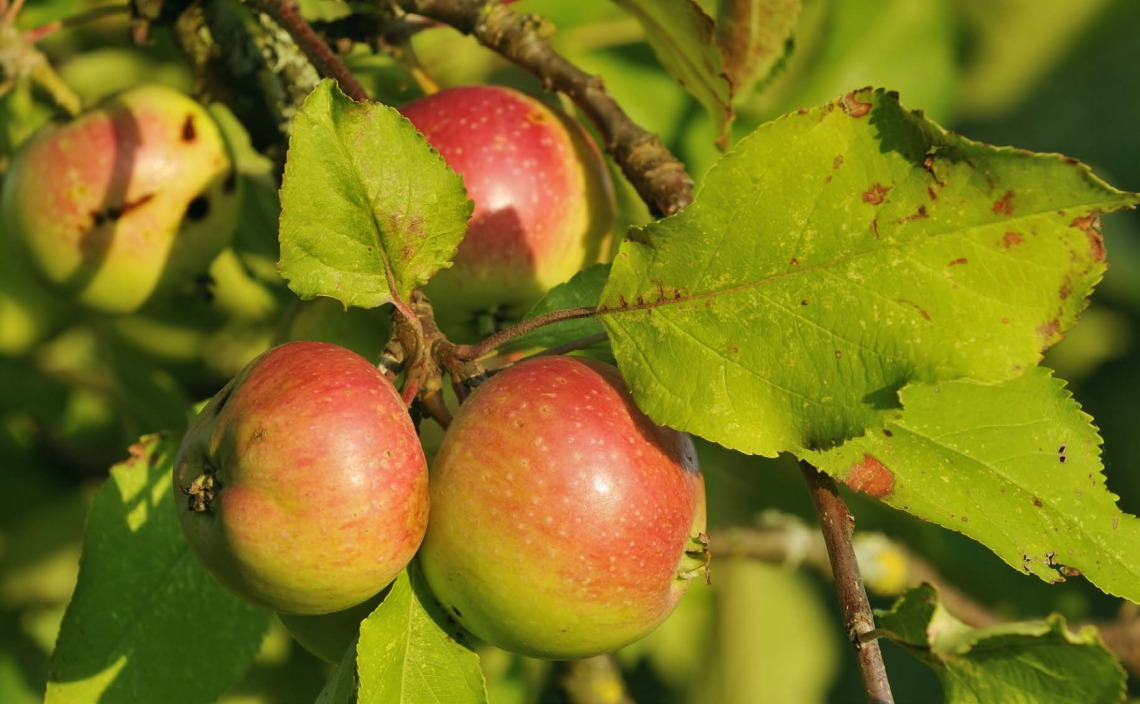
Allotments and a range of productive uses such as orchards, edible walkways and community gardens will be provided throughout the Garden Community to promote healthy lifestyles. Allotment provision must be well related to residential areas and community spaces, with suitable access arrangements, water supply and fencing. Allotments must sit sympathetically in the landscape and make provision for people with special educational needs and disabilities.
Part G: Sustainable Drainage Systems and Blue Infrastructure
Proposals must include Sustainable Drainage Systems (SuDS) for the management and disposal of surface water, in preference to piped systems, to avoid any increase in surface water flood risk or adverse impact on water quality and to prevent harm to offsite wildlife sites. Proposals must demonstrate how the SuDS feature(s) reflect and respond to site circumstances, landscape character and the green-blue infrastructure network, and have regard to Essex County Council's SuDS Design Guide.
SuDS should be designed as focal points by incorporating multifunctional green and blue infrastructure, provide amenity benefits, as well as linking habitats and creating enhanced areas for biodiversity by incorporating ditch habitat, reedbeds and pond networks. Consideration should be given to proposed health and safety measures for SuDS features and the design should address the usability, accessibility and safety of open space particularly for young children, the elderly and those with reduced mobility. Proposals must reduce post development run off rate back to the greenfield 1 in 1 year rate, with an allowance for climate change.
SuDS will be required to meet the following design criteria:
- The design must follow an index-based approach when managing water quality. Implementation in line with the updated Construction Industry Research and Information Association (CIRIA) SuDS Manual is required. Source control techniques such as green roofs, permeable paving and swales should be used so that rainfall runoff in events up to 5mm does not leave the site.
- Sensitively designed and integrated into green-blue infrastructure to create high quality public open space and landscaped public realm by providing viewpoints, footpaths, seating and signage where appropriate.
- Maximise opportunities to enhance biodiversity net-gain.
- Improve the quality of water discharges and be used in conjunction with water use efficiency measures.
- Function effectively over the lifetime of the development.
- The hierarchy of managing surface water drainage from any development in the Garden Community should be managed in accordance with this hierarchy: firstly, rainwater reuse; and secondly infiltration.
Proposals should be designed to include permeable surfaces wherever possible. Proposals for impermeable paving, including on small surfaces such as front gardens and driveways, will be strongly resisted unless it can be suitably demonstrated that this is not technically feasible or appropriate.
Part H: Integration of A120-A133 Link Road Mitigation
A comprehensive approach is required to ensure that the environmental mitigation for the A120-A133 Link Road, as specified in the conditions of the approved planning application, is fully integrated into the design of the Garden Community. This could include integrating those elements contained in the Landscape Plan, Landscape and Ecological Mitigation and Management Plan (LEMMP), Ecological Design Strategy, Farmland Bird Mitigation Strategy and Biodiversity Monitoring Strategy, which are conditions in the planning consent, with the landscape, multifunctional green-blue infrastructure, and ecological measures for the Garden Community.
Part I: Planning Application Requirements
- Proposals must include a green-blue infrastructure plan, which demonstrates how the scheme reflects and complies with the Strategic Masterplan; the Colchester Tendring Open Space Strategy requirements; the Healthy Living and Play Strategy required by GC Policy 6; and demonstrate how green and blue spaces have been integrated into the built form.
- Proposals must be supported with appropriate ecological surveys and landscape and visual impact assessments where necessary and include a biodiversity net gain calculation and biodiversity gain plan, which follows the latest Defra Metric and guidance on biodiversity net gain.
- The Councils will require the developer to enter into an appropriate legal agreement to ensure the long-term establishment, management, maintenance and monitoring of biodiversity mitigation, compensation, and net gain measures for a minimum of 30 years as part of the grant of any planning permission. It is anticipated that the developer will need to achieve this by entering into an agreement with a suitably qualified and experienced nature conservation management organisation to deliver the creation, and management of habitat in a development of this scale.
- An indicative Drainage Plan for the whole Garden Community must be prepared and approved in writing by the Councils before the determination of any planning application for development of the site.
- Proposals must include a Drainage Plan and SuDS Management and Maintenance Plan, which demonstrates how the scheme reflects and complies with the Garden Community wide indicative Drainage Plan setting out the long-term management and maintenance arrangements.
- Proposals must contribute to the Essex Coast Recreational disturbance Avoidance and Mitigation Strategy 2018-2038 (RAMS), or successor document, to mitigate for the in-combination effects of increased recreational disturbance across Essex.
Justification
The Vision for the Garden Community is that the natural environment will be its biggest asset. Green-blue infrastructure will allow residents to spend time, play, interact and grow and will provide a natural support system for people and wildlife and help to integrate built elements into the existing landscape. Open spaces will be created that contribute to a safe and secure environment by means of natural surveillance, physical security, cohesion, and a sense of community ownership help to create socially inclusive, active communities and seek to build in opportunities for residents to be active through their everyday lives. This reflects the Section 1 Local Plan requirement of the creation of distinctive environments, which utilise a multifunctional green-grid to create significant networks of new green- blue infrastructure. It is important that the landscape architect and lighting designers coordinate their plans to avoid conflict between lighting, planting strategies and conservation. Safe public spaces should be created that have incorporated good, consistent, and well-designed lighting throughout the development whilst maximising natural surveillance opportunities. The detailed lighting design should evidence current relevant standards and or relevant industry standards.
An appropriate amount of Suitable Accessible Natural Greenspace (SANG) provision, in accordance with Natural England (NE) guidance will be required. This must follow Natural England's latest SANG Guidelines (and successor documents), which are currently set out in the document 'Suitable Alternative Natural Greenspace (SANGs) for the Thames Basin Heaths Special Protection Area' (August 2021). Appendix 1 of the SANGs guidance provides a useful list of design features to be incorporated into publicly accessible green infrastructure and so provides a useful (but not exhaustive) checklist of design criteria to inform the detailed design of the landscape at later stages in the design process. The Councils encourage the incorporation of as many of these design features as possible. The developer should discuss the provision of SANG with Natural England.
Measures to integrate green and blue spaces into the built form will form part of the green-blue infrastructure network. This policy identifies examples of what sort of measures will be sought to maximise climate change mitigation and biodiversity extinction mitigation throughout the development. Appropriate ecological surveys and biodiversity net gain calculations will be required in support of planning applications and the mitigation hierarchy must be followed alongside good natural design principles. As required in the Section 1 Local Plan, avoidance, protection and/or enhancement of biodiversity assets within and surrounding the site; including Bullock Wood SSSI, Ardleigh Gravel Pits SSSI, Wivenhoe Pits SSSI and Upper Colne Marshes SSSI and relevant European protected sites.
Contributions will be secured towards mitigation measures in accordance with the Essex Coast Recreational disturbance Avoidance and Mitigation Strategy (RAMS). Wintering bird surveys were undertaken as part of plan preparation and further wintering bird surveys as part of proposals at application stage for each phase of the Garden Community are required. Where the surveys show that mitigation is required, development must be phased to deliver habitat creation and management either on- or off-site to mitigate any significant impacts. Any such habitat must be provided and fully functional before any development takes place which would affect significant numbers of SPA birds.
There is a requirement for sensitive habitats to be buffered, with additional planting or other agreed appropriate means to discourage access, and for substantial buffers against road corridors to be provided. Biodiversity net gain and a thriving ecological network is a strategic principle of the Garden Community. Where new areas of habitat are created, this should be targeted adjacent to or between retained existing areas of habitat in order to expand and link them, thus making them more resilient. Habitat creation and management should retain and enhance habitat links to the wider landscape, for example to the Colne Valley.
Biodiversity net gain calculations should be iterative The Councils consultants have undertaken biodiversity net gain calculations of the Councils Strategic Masterplan, which indicates that 12.5% biodiversity net gain can be achieved. Biodiversity net gain calculations will be updated by the developer for each proposal. The Councils will work with developers and provide coordination to maintain iterative biodiversity net gain accounting for the entire Garden Community. As a general principle, there are likely to be various development parcels/ proposals where the biodiversity net gain target cannot be met within the respective boundary. In these cases, the Councils will co-ordinate the 'banking' of gains achieved in the communal or green-blue infrastructure parcels, which can then be notionally apportioned off (or sold) to the developed parcels where net gain is not feasible to achieve. Biodiversity enhancements delivered in the link road and advance habitat creation in other areas of the site in the next few years could be 'banked' so that the wider Garden Community opportunity would have ready-made biodiversity units available. However, in line with the mitigation hierarchy (avoid, mitigate, compensate), the individual development parcels would have to demonstrate that all opportunities for biodiversity net gain within their parcels had been achieved first before relying on the banked biodiversity net gain value in communal green-blue infrastructure areas.
Applications for outline planning permission and phased development will require the submission of biodiversity gain information. Proposals for outline and phased permissions will require the applicant to outline strategies that will achieve the biodiversity gain objective across the whole site, and to demonstrate how this could be delivered on a phase-by-phase basis. This would include:
- the key principles that will be followed to ensure biodiversity gain commitments are achieved through subsequent detailed design
- how biodiversity net gain delivery will be tracked on a phase-to-phase basis, including the target percentage gains to be delivered at each stage. For most phased developments, the preference is for biodiversity gains to be 'frontloaded' into earlier stages. This will help to avoid the risk of net losses being caused by later stages being delayed or cancelled
- the approach to be taken in the event that subsequent phases do not proceed or fail to achieve their biodiversity net gain targets
- the pre-development biodiversity value for the whole site should be agreed as part of the site wide masterplan and used as the basis for agreeing detailed proposals through subsequent applications pursuant to the approved development
- a mechanism to link biodiversity net gain strategies to subsequent applications pursuant to the approved development
Properly managed trees and woodlands in urban and semi urban areas make a significant contribution to planning, design, and management of sustainable, resilient landscapes. Trees are important for health and wellbeing, wildlife and improving our environment. Increasing tree cover is one of the quickest and cheapest ways of mitigating climate change. The eastern half of the Garden Community offers the most opportunity for increasing tree canopy cover. Whilst tree planting and increasing tree canopy cover is encouraged, planting should only be undertaken in suitable locations and natural regeneration should be encouraged wherever possible. There is an opportunity to connect patches of existing woodland and ancient woodland within the Garden Community with the country park through new tree belt planting. Increasing tree cover in greenspaces – parks, playgrounds and around sports facilities, cemeteries/crematoria, verges, and other publicly open areas is the easiest and cheapest way of maximizing tree coverage. Tree creation in orchards, woodland, and arboretum should also be incorporated.
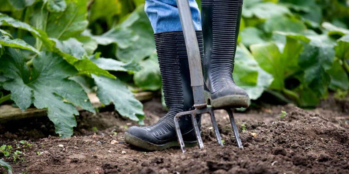
Allotments and productive landscapes help to promote healthy lifestyles by promoting healthy eating and community integration. There are excellent examples of community gardens being beneficial for children and adults with disabilities (e.g. learning and sensory). The strategic principles for the Garden Community include the provision of space for a range of productive uses such as orchards, edible walkways and allotments. Their importance should not be underestimated, and opportunities for their creation should be provided throughout the Garden Community.
The strategic principles for the Garden Community recognise that natural flood risk management and carbon capture will be seamlessly incorporated in the ecological network, making the natural landscape "work hard" and deliver multiple benefits simultaneously.
The NPPF and Planning Practice Guidance (PPG) set out the requirements for the use of Sustainable Drainage Systems (SuDS) to minimise the risk of flooding from new development. The use of SuDS to manage water run- off is an important tool in minimising flooding by increasing the provision of permeable surfaces in an area that allows water to seep gradually into the ground, rather than running directly into a drainage network, thereby reducing the risk of overloading the system. SuDS can also reduce the impact of diffuse pollution from run-off and flooding. The effective use of permeable surfaces, soakaways and water storage areas should be incorporated. Early consideration should be given to the potential to use SuDS to identify when and where the use of such technologies is feasible and to also identify which type of SuDS is most appropriate to site conditions. Only where there is a significant risk of pollution to the water environment, inappropriate soil conditions and/or engineering difficulties, should alternative methods of drainage discharge of water from a site be considered.
A drainage plan and SuDS management and maintenance plan will need to be prepared to ensure that the need for SuDS has been properly considered as part of the planning application process. Developers will need to enter into early discussions with the Councils and the Lead Local Flood Authority and as part of discussions, maintenance and long term adoption responsibilities should be explored and agreed, as part of the SuDS approval process, prior to the start of development.
This policy should be read closely with GC Policy 9: Sustainable Infrastructure. GC Policy 9 also includes reference to green infrastructure and includes requirements for water supply and wastewater to ensure new development does not have an adverse effect on any habitats site or nationally protected sites and complies with environmental legislation.